

You can find on this page the South Africa wine map to print and to download in PDF. The South Africa wine regions map presents the vineyards and wine growing areas of South Africa in Africa.
The South Africa wine map shows all wine growing areas of South Africa. This wine regions map of South Africa will allow you to easily localize all appellations and main grape varieties in South Africa in Africa. The South Africa vineyards map is downloadable in PDF, printable and free.
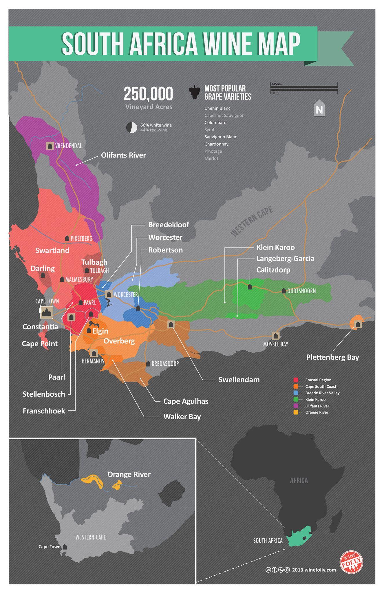
The Cape winelands stretch from the rugged mountains and multi-directional slopes of the coastal region to the open plains of the Klein Karoo where viticulture takes place mainly in the riverine valleys. South Africa vineyards are mostly situated in the Western Cape near the coast as its mentioned in South Africa wine map. Rainfall on the coastal side, where fynbos and renosterveld vegetation flourish, measures up to 1 000mm per year. Travel over the mountains into the hinterland and the rainfall decreases dramatically with the vegetation dominated by hardy succulents, cycads and aloes.
The vineyards of South Africa cover 140 000 hectares mainly in the province of Western Cape as you can see in South Africa wine map. The most renowned wine regions of South Africa are as follow: Stellenbosch (Cabernet sauvignon, Merlot, Pinotage, Syrah, Chardonnay, Sauvignon blanc). Paarl (Cabernet sauvignon, Syrah, Chardonnay, Sémillon, Viognier, Chenin blanc). Constantia (Sauvignon blanc, Muscat de Frontignan).
Vineyards are found in the Northern Cape Orange River region, where the flat, barren landscape is dominated by the Kalahari Desert as its shown in South Africa wine map. Most of South Africa wine-producing regions have a Mediterranean climate, significantly influenced by the meeting of the Atlantic and Indian Oceans.