

You can find on this page the South Africa road map to print and to download in PDF. The South Africa driving map presents the detailed road network, main highways and free motorways of South Africa in Africa.
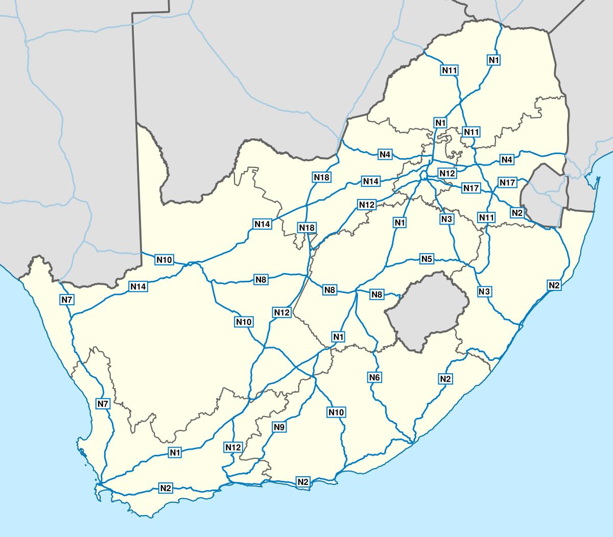
The South Africa road map shows all roads network and main roads of South Africa. This road map of South Africa will allow you to preparing your routes and find your routes through the roads of South Africa in Africa. The South Africa roads map is downloadable in PDF, printable and free.
Roads are a crucial component of South Africa transport system and economy. According to the Land Transport Survey, which was released by Statistics South Africa in 2018, 77.3% of freight categorised as land freight in South Africa is hauled on its roads, accounting for 73.8% of total land freight income as its shown in South Africa roads map.
The dependence on road infrastructure in South Africa implies that the condition of roads has direct bearing on the ease of movement of goods and people across South Africa, which impacts overall economic growth. In this regard, SANRAL carries out upgrades, maintenance and strengthening programmes of the non-toll and toll portfolios on national roads. About 49 000 kilometres of the South African paved road network remain under the control of provincial transport departments as its mentioned in South Africa roads map.
National Roads are designated with the letter N followed by a number indicating the specific route as you can see in South Africa roads map. On signs national roads are shown by a pentagon with the number of the road inside. Approximately ten thousand people die on roads in South Africa yearly. The national speed limit is between 40 or 80 km/h in residential areas and 120 km/h on national roads/freeways/motorways.
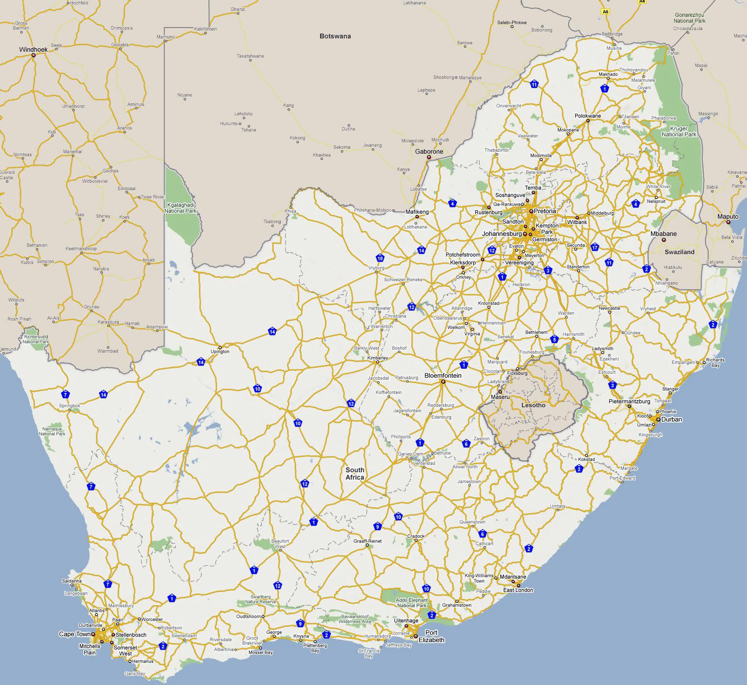
The South Africa highway map shows toll and free motorways of South Africa. This highways map of South Africa will allow you to prepare your routes on motorways of South Africa in Africa. The South Africa highway map is downloadable in PDF, printable and free.
The National Road System is a network of highways that links all the major population centers in South Africa. The system was mostly built by the Apartheid government during the 1970s, although construction of new roads and repairs of existing stretches continue today. The system was modeled on the United States Interstate Highway network, an idea first brought into effect by US President Dwight D (see South Africa highway map). Eisenhower during the 1950s, based on the German Autobahn, which he experienced when touring Germany after the Second World War.
The Trans-African Highway network comprises transcontinental road projects in Africa being developed by the United Nations Economic Commission for Africa (UNECA), the African Development Bank (ADB), and the African Union in conjunction with regional international communities as its shown in South Africa highway map. They aim to promote trade and alleviate poverty in Africa though highway infrastructure development and the management of road-based trade corridors. The total length of the nine highways in the network is 56,683 km.
In some documents the highways are referred to as 'Trans-African Corridors' or 'Road Corridors' rather than highways as its mentioned in South Africa highway map. The name Trans-African Highway and its variants are not in wide common usage outside of planning and development circles, and currently one does not see them signposted as such or labelled on maps, except in Kenya and Uganda where the Mombasa-Nairobi-Kampala-Fort Portal section (or the Kampala-Kigali feeder road) of Trans-African Highway 8 is sometimes referred to as the 'Trans-Africa Highway'.