

You can find on this page the South Africa trains map to print and to download in PDF. The South Africa railways map presents the rail network and shows high speed rails routes of South Africa in Africa.
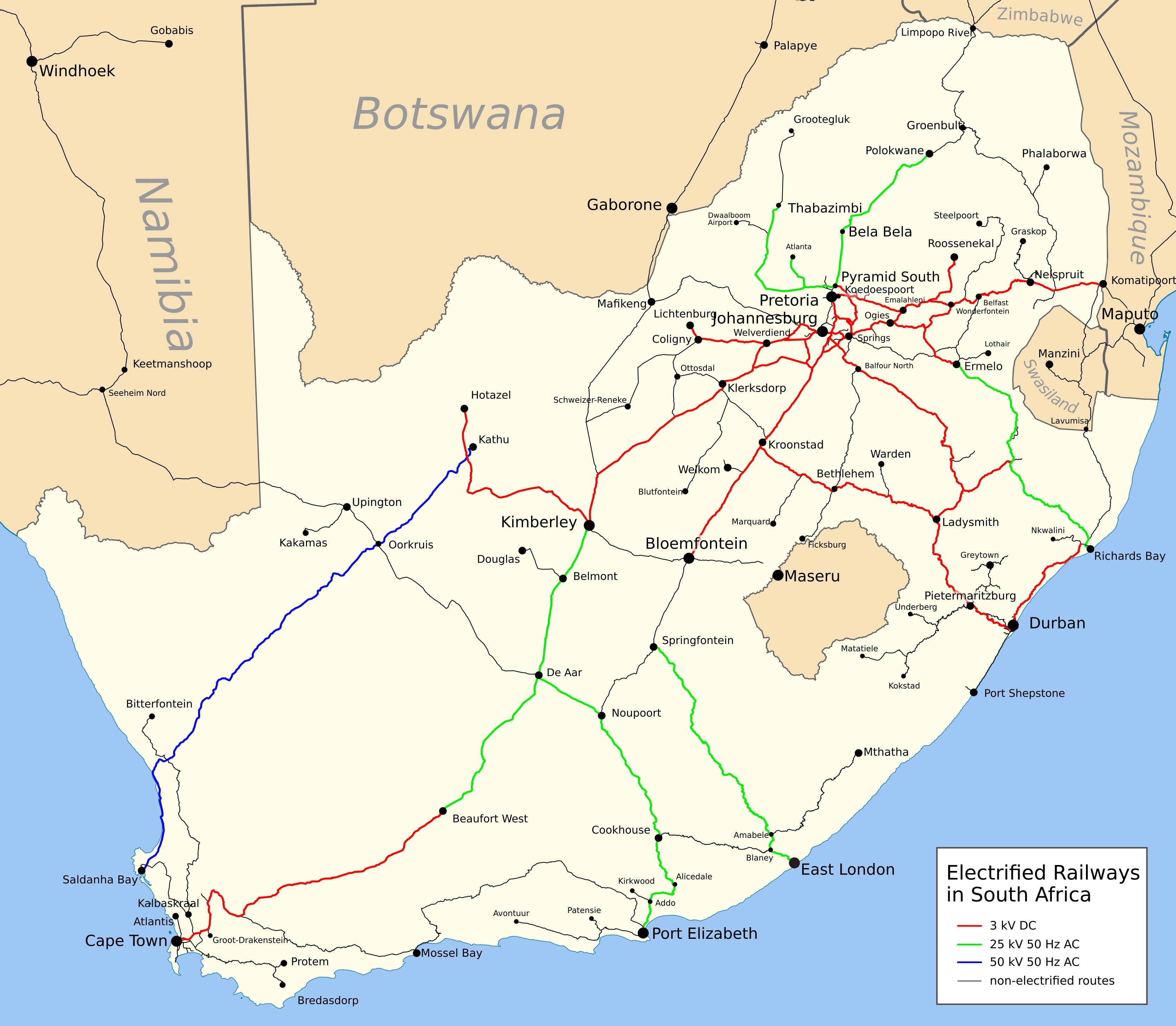
The South Africa rail map shows all the railway stations and lines of South Africa trains. This train map of South Africa will allow you to easily travel by train in showing the major rail routes and high speed rail routes of South Africa in Africa. The South Africa rail map is downloadable in PDF, printable and free.
Rail transport in South Africa is the most important element of the country transport infrastructure. All major cities are connected by rail as its mentioned in South Africa rail map, and South Africa railway system is the most highly developed in Africa. The South African rail industry is publicly owned.
Transnet (and previously Spoornet and its predecessor) became famous for its luxury rail lines, most notably the Blue Train, which runs from Cape Town to Johannesburg. The Blue Line as you can see in South Africa rail map has frequently been named the best luxury train line in the world, and the 1,600 kilometres (990 mi) run is a popular tourist attraction for South Africa. Transnet is moving towards an emphasis on freight, rather than passengers, to keep the rail system profitable.
Nearly all railways in South Africa use a 3 ft 6 in (1,067 mm) narrow gauge track (Cape gauge) as its shown in South Africa rail map. This was selected in the 19th century to reduce the cost of building track across and through the mountains found in several parts of the country. The Gautrain rapid transit railway uses 1,435 mm (4 ft 8 1⁄2 in) (standard gauge). Ultimately, the hope is that the conversion to standard gauge will also enhance rail potential as a freight carrier.