

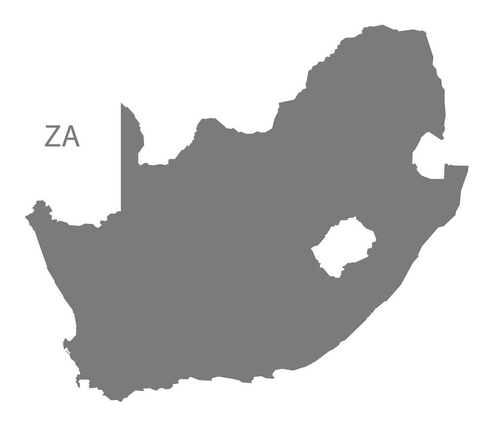
You can find on this page the blank map of South Africa to print and to download in PDF. The contours map of South Africa presents the international boundary of South Africa in Africa. You can use the vector map of South Africa for personal or educational use.

The blank map of South Africa shows the country South Africa empty. This blank map of South Africa will allow you to use the map for personal activities or educational with children for example (drawing). The empty map of South Africa is downloadable in PDF, printable and free.
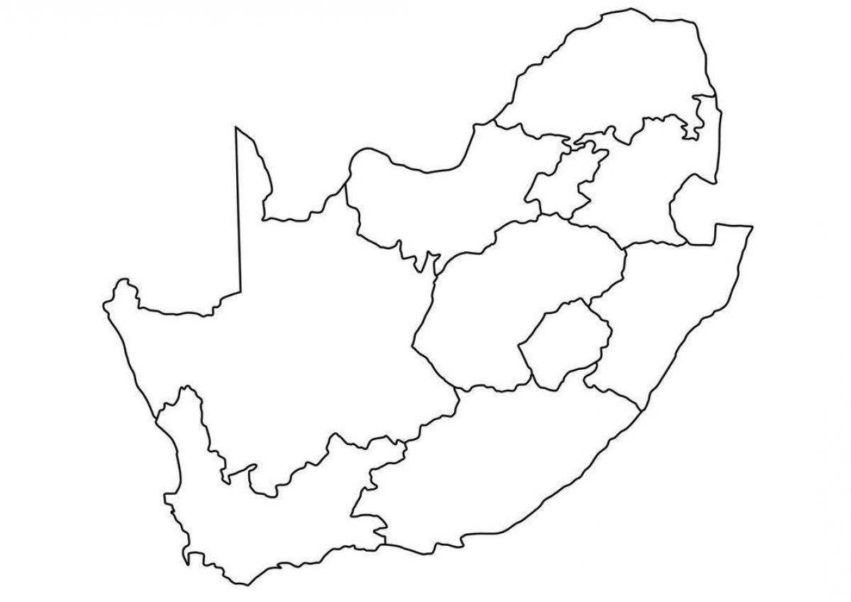
The blank map of South Africa shows the location of its 9 distinct provinces. The Constitution of South Africa divides the country into nine provinces, each with its own Premier, provincial members of executive councils and Legislature. The provinces are: Eastern Cape, Free State, Gauteng, KwaZulu-Natal, Limpopo, Mpumalanga, Northern Cape, North West, Western Cape.
This blank map is showing South Africa Provinces with provincial boundaries. With an area of 372,889 sq. km, Northern Cape is South Africa largest province while Gauteng is the most populous one. The country has three capital cities. Pretoria, Cape Town, and Bloemfontein served as the executive, legislative, and judicial capitals of the country respectively. Johannesburg is the country largest city.
South Africa is divided into nine provinces as shown on the blank map of the country of South Africa. The provinces are further divided into metropolitan and district municipalities. The latter is further sectioned into local municipalities. All municipalities are divided int still smaller units called wards.
The South Africa map outline shows all the contours and international boundary of South Africa. This outline map of South Africa will allow you to easily learn about neighboring countries of South Africa in Africa. The South Africa contours map is downloadable in PDF, printable and free.
Total land borders of South Africa is 4,862 km. Bordering countries land borders are as follow: Botswana 1,840 km, Lesotho 909 km, Mozambique 491 km, Namibia 967 km, Swaziland 430 km, Zimbabwe 225 km. South Africa has coastlines on both the Atlantic Ocean and the Indian Ocean to the south as its mentioned in South Africa map outlines.
The outline map represents the mainland territory of South Africa. The country also has several islands on the Atlantic and Indian Oceans. can be downloaded for free, and used for educational purposes like map-pointing activities. This outline map of South Africa country can be used for teaching projects.
South Africa has 2,798 kilometres (1,739 mi) of coastline as its mentioned in South Africa map outlines. It is bordred as follow: to the north the neighbouring territories of Namibia, Botswana and Zimbabwe; to the east are Mozambique and Swaziland; while Lesotho is an enclave surrounded by South African territory.
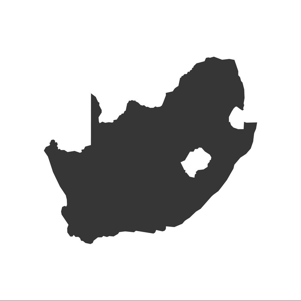
The vector map of South Africa shows entire surface of South Africa empty. This vector map of South Africa will allow you to make changes or add details to the map of South Africa in Africa, for personal or educational purposes. The vectorial map of South Africa is downloadable in PDF, printable and free.
South Africa looks like a rhino head as its shown in South Africa map vector. That it does is a pretty massive coincidence, as there are not too many rhinos left in the world and one of the few places they still are in is South Africa. It is particularly coincidental that the rhino-that-is-South Africa has two horns, as that is the exact number of horns that African rhinos have. Asian rhinos only have one horn. It is also pretty convenient that Lesotho exists, as that is the rhino eye.
Stretching latitudinally from 22°S to 35°S and longitudinally from 17°E to 33°E, South Africa surface area covers 1 219 602 km2. The Prince Edward and Marion islands, annexed by South Africa in 1947, lie some 1 920 km south-east of Cape Town as its mentioned in South Africa map vector. South Africa surface area falls into two major physiographic categories: the interior plateau, and the land between the plateau and the coast.
South Africa is the African country that occupies the most southern part of Africa. The country occupies an area of 1,221,000 km², compared it is larger than four times the size of Italy, or slightly less than twice the size of the U.S. state of Texas. This part of the African continent is located close to three Oceans, namely the South Atlantic Ocean, the Indian Ocean and the Southern Ocean as you can see in South Africa map vector.